November 13, 2013

Rain Harvesting and How To Do It -- a FREE Workshop

June 26, 2013 turned out to be the last day of significant flooding this year -- knock on wood. Having said that, we hear there's a warm up coming this weekend [11/22-11/27/13], which could encourage Mother Nature to wake from her slumber and unleash one final year end deluge. Nah. She wouldn't do that. . .

Meanwhile, as a public service, we're passing along this invitation from the Chicago Sustainable Backyards Program to Oak Avenue residents who would like to do something more with the water coming off their roofs -- besides sending it into their neighbors' yards and overwhelming the sewers. If you also have a flooded front yard AND backyard, this may not solve ALL your problems. But it's a start. Meanwhile, to get you started, our Village is selling $100 rain barrels for $25 to Northbrook residents -- limit two. Click HERE.


September 7, 2013

A Couple of Trips Down Memory Lane

1) Below is a 1996 photograph of the standing water at 2432 Oak Avenue. What you see is just one of eight backyards that began flooding on the north side of Oak Avenue after the village allowed the grade to be raised at 2428 Oak Avenue [R]. The grade was raised to construct the new garage in the picture and a long cement [impermeable] driveway. In this picture, the garage at 2428 is approximately one foot higher than the yard at 2432. The water is almost a foot deep in this picture. And the yard didn't drain for days. That's why the owner took the picture. 

Since this photo, the house with this backyard at 2432 has been torn down for a larger house with a bigger footprint. The grade was raised to the same level as the garage and driveway at 2428. 


2) Even though we took this picture [below], we're not sure what the date was. Sometime in the eighties, we believe. The original reason for taking the picture was to honor the beautiful elm tree that would be sacrificed at the altar of ending street flooding by adding curbs. 

Turns out the new curbs were a purely cosmetic change, despite what one resident, a longtime member of the Planning Commission, led us to believe. The street flooding continues to this day. 

The reason for posting this picture now is to point out why many people on Oak Avenue thought that the sewers had been improved when the curbs were added. Au contraire, mon ami, those pipes are only the intake pipes for the street grates. Not anything related to improving the sewers. 

The tree is gone, replaced with an oak. The three bedroom house with a one car garage in the picture was torn down, replaced with a McMonster. 


September 3, 2013

Go Green Northbrook

A new, eco-conscious group called Go Green Northbrook has formed under the direction of Northbrook resident, Doug Gerleman. 

According to the August 22, 2013 issue of The Northbrook Tower, the Go Green group formed during April's Earth Day event in downtown Northbrook. They have since attended the July 18 meeting of the Village's Environmental Quality commission to introduce themselves. EQC welcomed the new group and agreed to create an ongoing working relationship. 

In conjunction with Go Green reps from fourteen other North Shore suburbs, Go Green Northbrook might tackle the use of plastic bags in the area, making a push for the use of non-disposable shopping bags. Sunset, Whole Foods, and other neighborhood chains already have non-disposable bags for sale. Sunset also accepts plastic bags for recycling. 

Also on the agenda includes the construction of a recreational trail for bicycles or walkers by the North Branch of the Chicago River, near Willow Festival between Techny and Willow roads. 

Perhaps the most relevant initiative to Oak Avenue Flooding victims is the construction of more rain gardens in Northbrook to help curb flooding issues. The major issue with rain gardens is how to insure that future property owners will continue to maintain them. 

According to Gerleman, the local of group of fifty-eight residents is setting up a Facebook page to keep residents up to date with Go Green Northbrook projects, as well as recruit more volunteers. 

Go Green Northbrook meets once a month. For more information, contact Doug Gerleman at gerlemand@comcast.net.

August 30, 2013

Bracing for the Rain

Here's what the forecast looks like for tonight, although some thunderstorms have already started pounding the area. Naturally, we're curious about how long they will last. We're also curious what kind of runoff there will be from the new construction. It's 5:50 PM. 


August 7, 2013

August Construction Continues On the House That Will Add To Future Flooding

After the basement had been dug out, there was a huge pile of dirt in the front and the back of the house. The first two pictures are from the day after all that dirt was smoothed down by one of those pocket-sized, earth mover tractors. 

The last two pictures are from a day or two after all the dirt had been leveled. A big shovel came in and dug a bunch of dirt up again to hook up the house pipes to the sewer lines. That may include the sump pumps as well as the catch basin or private drainage pipes. If anybody has a better handle on what those pipelines are for, feel free to 'splain.  


July 29, 2013

The Village Answers Flood Map Questions

We sent a letter to the Village to ask about the accuracy of the flood maps first discussed in an earlier entry HERE. 

Here's the response we received with answers from the ERA consultants in red. ERA is the company that does the maps and gives a thumbs up or down for improvements to our infrastructure. See if you think these replies sound like "We're the government and we're here to help." Or just more B.S. wrapped in jargon.  


Dear [Village of Northbrook],

The maps included in the H & H report show extensive street flooding on Westcott and Maple, where arguably NONE exists. 

Where is the information for these maps coming from? The information for the surface elevations was obtained through the Village’s Geospatial Information System (GIS) which provides elevation information at one foot intervals.  Contour mapping is generally considered accurate to within one half of the contour interval, so, in this case, vertical accuracy of the GIS should be plus or minus six inches. This area is relatively flat so there still may be some deviations in the field that are within the six inch tolerance.  The storm sewer routing information was obtained from the Village’s utility atlas information.

Oak Avenue Resident suggests: Get your butts out in the field.

There certainly wasn't flooding on Westcott or Maple during this last storm. While we were inundated on Oak. Far more than indicated on your map. And during the July 2010 storm, I had water up to my house from the street. As did several other homes. First, the storm model shows that the flooding in the area of Wescott and Maple occurs prior to the flooding in the 2400 block of Oak Avenue.  It also subsides sooner.  Therefore, it could have been that, once the flooding in the 2400 block of Oak Avenue was observed, the flooding at Wescott and Maple had already subsided. 

Oak Avenue Resident suggests: Storm model? Really? Get your butts out in the field. 

The representastion of street flooding in the 2400 block of Oak Avenue should be well past the sidewalks on both sides of the street and more extensive from east to west.   The limits of the extent of flooding may be somewhat different based upon the GIS one foot contour mapping. 

Oak Avenue Resident wonders: Huh?

Secondly, there is NO representation of the overwhelming backyard flooding we get on the 2400 block of Oak Avenue like there seems to be in the 2500 block. There is NOTHING ON THE MAP.  Following the storm, we ran a computer model using the same information that was used for the information in the report, but updated to include hydrologic conditions observed during the recent storm.  The output from this model depicts the backyard flooding in the 2400 block and seems to provide an good representation of the conditions that were reported during and after the recent storm event.

Oak Avenue Resident asks: So the previous flood maps are wrong and you're going to correct them?

We have proof with video and photographs. And I guarantee it's more than anything in the 2500 block, which is on higher ground.

Has there been a mistake?  As discussed in the responses above, using the base information provided from the GIS system and utility atlases, when hydrologic information from the most recent storm is put into the computer modeling, it seems to provide a fairly accurate representation of the conditions reported. The model could be updated with more accurate topographic survey information but we don’t believe it would substantially change the results.

Oak Avenue Resident gets impatient: This seems to contradict your previous answer. Could you possibly write something that's jargon-free?

What proof do you have that there really is flooding in the backyards of the 2500 block of Oak on the north side? Or that there is actually street flooding on the 2500 block of Maple? We have seen none. 

The backyard flooding shown on the map actually looks more like the 2400 block of Oak than the 2500 block. According to the GIS contour information, a significant amount of flow from the rear yards in the 2400 block of Oak Avenue runs onto Oak Avenue about three houses west of Western.   If this flow area is restricted by obstructions in side yard ditches or swales it likely makes it more difficult for the water to drain out. These conditions could cause additional backyard flooding in the rear yards of the 2400 block than what is shown in the report.  A detailed topographic survey of the side and rear yards in this area would be necessary to verify this condition.

Oak Avenue Resident suggests, once again: Get your butts out in the field. 

And whaddya mean the "significant flow" occurs "about three houses west of Western?" It occurs in the backyards of the third, fourth, fifth, and sixth houses west of Western. But you wouldn't know that, because you don't get out in the field. 

Even more egregious, to suggest that "obstructions" in the backyards on Oak Avenue are the reasons for the sudden enormous backyard flooding is another example of Village incompetence. As if the huge footprints and elevated grades allowed for the new construction on Maple Avenue had nothing to do with the oceans of displaced water that suddenly had nowhere to go, but down hill.  

Can you explain how the alleged "obstructions" blocking the flow from the Oak Avenue yards occurred at the same time? To all those yards? Did we mention that the flooding was rIght after the mega-homes went up on Maple Avenue? 


But then, what more can we expect, when no one from the Village bothers to come out to the field?

Can you offer some way of proving that these maps are accurate, please? Hopefully, the explanations provided above are helpful in providing a better understanding of the accuracy and to some degree the limitations of the information shown on the maps.

Oak Avenue Resident replies to ERA Consultant:  Short answer? No. 

It's pretty clear none of the ERA people have been out to the 2400 block of Oak Avenue, EVER. 

July 21, 2013

Anybody Know What This Is?

People seem reluctant to comment on this blog. But we have a question. You can be anonymous, when you answer. Or email us at oakavenueresident@gmail.com. Anyway, we took a picture of this U-shaped pipe thing by the fence of the new construction at 2429 Maple. What's it for? [UPDATE: We got close to the fence the next day and saw a tag that said it was a window well. There's even a ladder, so we're thinking it's a very deep window well.] Also notice the little sign with red type on the right -- NO TRESPASSING. Probably because we stand at the fence and shoot pix. 

Some Feedback from The Flooding Survey

Ironically, a couple of weeks before the flood of June 26th, a neighborhood flooding questionnaire was left in the mailboxes of the twenty-one or so homes on the 2400 block of Oak Avenue. Wow, here's a chance for residents to express their frustration about the water problems, anonymously, if they chose. And only eight families took the time to reply. 

Even more ironic was the number of homes with reclamation vehicles parked outside after the flood. The very homes that belonged to people who were too busy bailing water to fill out the survey, apparently. 

Meanwhile, we promised to provide the results from the surveys we received. So here's a tidbit or two to give you an idea of what it's like to live in Water Land. 

Straight from the survey, here are two comments about the history of flooding on the 2400 block of Oak:


ii. Over 45 years I have lived on both the North and South sides of the street and had flooding on both sides. We have altered landscaping, put in a raised basement floor, a surface pump, and done tiling from the backyard to the street with the Village’s permission. Everything has helped, nothing has made for a completely dry basement in a heavy flooding rain.


iii. We have lived here for 16 years and have never had as many problems as the last few years, which directly coincides with all of the new homes being built around us. We are very disappointed in the Village of Northbrook for allowing such large homes to be built on such small properties – eating away at all of the land – land that used to drain water, but now the sewers are inundated. They don’t care about all of the homeowners who have been here for years. All they care about is building, building, building. Northbrook was going to work on our sewers on our block, but are now re-evaluating because of cost. Well, we can’t afford an overhead sewer system – and $5000 barely covers 1/3 of what it will cost – not to mention the very intrusive way this system will be put in. Northbrook should get their priorities straight.

Here is another owner's description of just his losses for ONE flood. And we've had three floods already this year. Multiply this by the number of homes we know for sure that were flooded on June 26th -- ten. Then multiply by the number of floods this year. Then multiply by the number of floods since the three one-hundred year floods of the 1980s. 

7. List the possessions you have lost to flooding along with their value:

i. Furnace = $2000
Water Heater = $1200
Washer/Dryer = $1200
Carpeting = $1800
Drywall = $300
Furniture = $3000
Toys = $1000
Electric = $3000
Sump Pump with back up = $600
[This was only one flood out of several floods]


The Village's solution is to expect the victims of the flooding to fix the problem themselves --  a problem the Village has caused by allowing the grade to be raised and permitting footprints that are too large [a quote from a Village engineer in 2008, by the way]. And those are just two of the usual suspects. The biggest problem is that the storm sewers can't handle the water that has no where else to go.  

With every thunderstorm, Northbrook has demonstrated its clear and continuing failure to prepare ALL of its residential infrastructure for the future, which is HERE. This, despite decades of flooding throughout the Village. 

Contractors continue to get building permits which allow them to build mega-houses on inadequate lots, without regard to the environmental effects they will have on the existing homes. And despite pleas to the VIllage from the surrounding homeowners. 

Time will tell. What goes around comes around. 


July 18, 2013

We Follow the Progress of the New Construction

Here are some more pictures of the latest tear-it-down-build-it-bigger houses on the south side of the 2400 block of Maple Avenue. The pile of dirt is supposed to be used as "backfill" to quote someone we asked at the site. It won't be hauled away. Hmmm. Looks like enough dirt to raise the grade in back. It also looks like the plastic pipes for an in-ground sump pump are being laid. We were also told that there will be only ONE catch basin. "Because the sewers can't handle more." Duh. Wonder if there's anyway to tell whether the sump water will be pumped into the backyard or the Maple Street sewers. Inquiring minds want to know. 


July 12, 2013

And the Walls Came Tumblin' Down!


The house at 2429 Maple Avenue has been torn down. The third house to be torn down on the south side of the 2400 block of Maple. Will the new house contribute to the water in the Oak Avenue backyards? Did Liberace wear rhinestones? Based on previous experience with the other two teardowns on Maple, it won't take much time to find out. As soon as the house is framed, we should be prepared for the result. Someone suggested sandbagging our property lines. 

Meanwhile, we stopped by the morning after the tear down. The Tonka shovel was removing a lot of broken concrete. To our untrained eye, the hole seemed shallow, so we wondered whether the home had been built on a concrete slab with a crawl space instead of a basement. Will the new house have a traditional basement? If so, where will that extra dirt/water go? 

We'll keep an eye out for signs of catch basins [don't expect more than one, since the sewer system isn't equipped to handle two.] There is a pile of excavation dirt in the upper right in some photos. It should be used for backfill. Will it?


July 8, 2013

July 7 • Rain & No Electricity

At 6:30 AM, the electricity went out for two minutes. About three hours later, the electricity went out for good, shortly after the rain started. The usual scenario is that the electricity goes out on the north side of Oak Avenue. Only. This time is no exception, since lights were still visible on the south side of Oak. 

Another infrastructure thing. 

Imagine your entire power source is from one long extension cord hooked up to a neighborhood over a mile away. That's Com Ed's Rube Goldberg set up for the north side of Oak Avenue. That's the only thing that keeps our refrigerators, air conditioners, coffeemakers, microwaves, TVs, hair driers, stoves, etc., on the grid. We're only one wet wire away from melted ice cream and a bad hair day.  

Today we noticed something new. Two wires down at the corner of Oak Avenue and Cedar. We couldn't tell whether they were power lines or phone wires. No wind today.  But there were trucks in that area installing new telephone poles a few weeks ago. Today the whole corner was also wrapped in yellow crime scene tape to keep people and cars out of the area, but there were no service trucks around. 

The good news? The rain was only drizzle. 

[Action photo of downed wires below]


 We noticed after posting this picture that there is a village truck doing what we were doing when we encountered the yellow tape -- turning around. 
 The tape was wrapped around a tree, then attached to a sign, 
and blocked the street in three directions.
 We didn't know what the tape was for. Finally we realized that there were two downed wires off a telephone pole. At least we thought it was a telephone pole. 


We will go to any lengths to provide our readers with on the spot reporting when the first drop of rain falls. As long as we don't have to get out of the car.


July 6, 2013

So Many New Houses, So Little Infrastructure

Just for grins, we got out the preliminary design map from 1997, which was sent to Oak Avenue residents to illustrate a drainage pipe with catch basins. This was after eight yards flooded, when the VIllage allowed new construction on Oak Avenue that raised the grade. The water wouldn't drain for weeks, subsequently destroying one backyard,  [See a pattern? Raised grade, increased footprint, sump pumps dumping into backyards, failure to upgrade infrastructure = water problem.] 

The drainage pipe idea was rejected, although that's exactly what was needed. The residents didn't think they should have to pay $2000 apiece for it, when the Village caused the problem. And those were 1997 prices. Also, notice how the pipe was going to empty into Oak Avenue's storm sewer? Right where all the street flooding has occurred for decades. Really? That's where you would pipe Maple Avenue's run off? On purpose?

The Village figured out a way to solve the problem of standing water, after the resident whose backyard was destroyed came to a meeting with the Village and excised a few body parts, verbally. The Village managed to do something to a framitz in a gismo on Western Avenue [public property], so no residents had to pay any money. And voila! Rainwater began to drain from our backyards again. 

Today we are using the old map to compare the change in the 2400 Oak/Maple Avenue landscape between then and now. Before comparing 1997 with a satellite photo of the neighborhood in 2013, we colored in what we thought were the basic changes. Turns out there were a couple of new ones we didn't know about. Or old ones we'd never noticed.

orange = no change from 1997 

X red = teardown, replaced with a new, larger house [X with a circle around it is a teardown in progress]

YELLOW = an addition has been added to the original house creating a bigger footprint [2424 and 2428 added on in 1995 or 1996 -- 2410 added on in 2003 or 2004. 

Comparing 1997 to 2013, there are currently five houses with bigger footprints on the north side of Oak Avenue. That includes 2440 [big addition] and 2406 [patio addition].

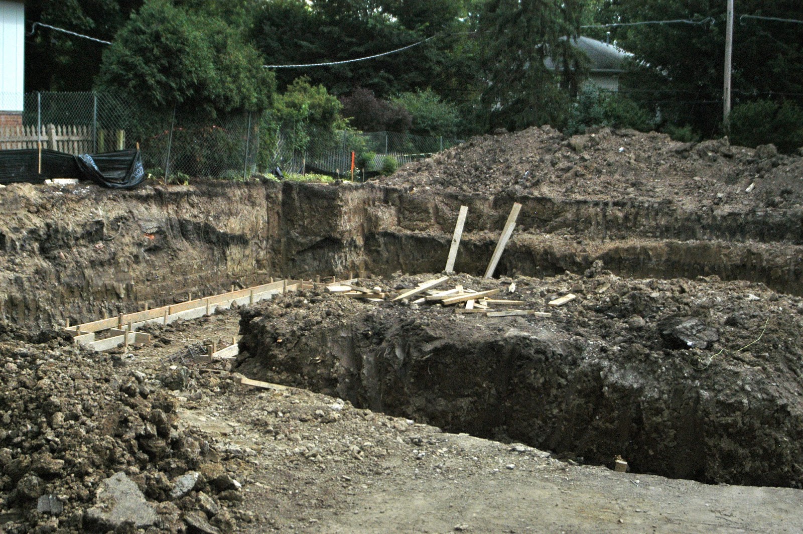
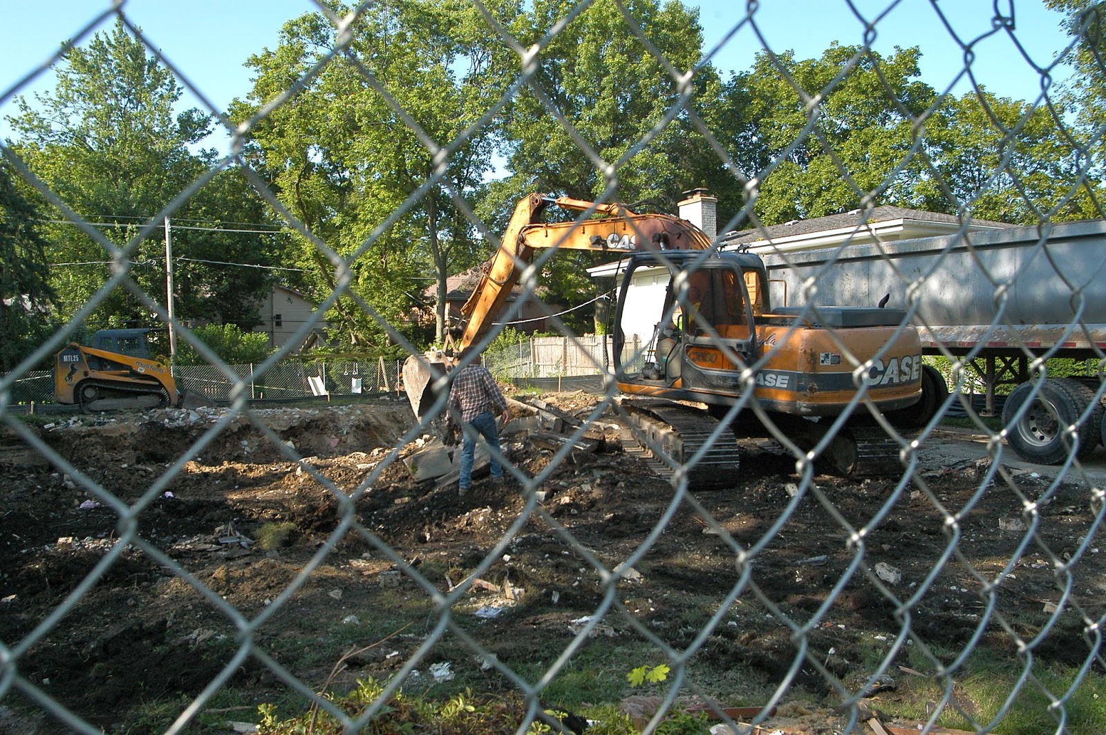
On the Maple Avenue side, there have been two teardowns/new megahouses with a third in progress. 

You can see there's a huge difference in the footprint for 2417 Maple Avenue. In '97 there was enough backyard to handle plenty of rainwater run off. Now the angle of descent [pitch] has been cut in half. With even more elevation. And a lot more water that needs a place to go. 

1997 MAP

Satellite Map for Comparison
Above is the satellite map for the north side of Oak Avenue 
and the south side of Maple Avenue to compare with the 1997 map. 

            Below is the map for the south side of Oak and the north side of Illinois. 
We can confirm four teardowns replaced by new homes on the south side of Oak. Also three to five homes with additions. [Three for sure.] So seven out of eleven houses have bigger footprints on the south side of Oak. And it may be as many as nine. 

On the Illinois side, there are six teardowns, replaced by new homes. Unfortunately, we don't have anything to compare the landscape change. 

Except for curbs, which turned out to be cosmetic, there have been no upgrades to the storm water system in the neighborhood.  

July 3, 2013

A Film Noir of Oak Avenue Basement Flooding

After 2007, street flooding was easy compared to what was happening to several backyards on Oak Avenue. Two mega houses had been allowed to raise the grade from two feet to four feet on the properties behind us. After those homes were built, the runoff was so great, it started coming into our homes via the window wells.

Meanwhile, this video is black, because one of the other perils of living on the 2400 block of Oak Avenue during a storm is the high risk of losing the electricity. [Living on Oak Avenue on a bright, sunny day with no wind can also be perilous to your electricity.] 

We recorded some amazing sounds of destruction during the storm that started around midnight on July 11, 2011. At that time, the event was called a microburst.  

Except for a few seconds of weak flashlight trying to shine its light down the basement stairs, you can't see anything. But you can sure hear the water from the completely flooded backyard pouring into the basement. There's nothing quite so shocking as the sound of water rushing into the house. 

"Hello. This is the Mississippi River calling. We want to use your home for a holding tank."  

There was so much water pouring from the backyard that the force of it overwhelmed the window wells like someone just opened the gates of a dam. On this occasion, we were inside taking this video, so you can hear the water rushing into the basement [think Niagara Falls] after the window wells had filled up. Without electricity there was no way to pump water. So we were simply taking deep breaths and thinking zen thoughts. 

You can listen HERE

That storm took out the furnace, the washer/dryer and the hot water heater. For the second time. Yes, it also happened earlier. The first time, we naively thought it was a gutter problem and had them rerouted away from any window wells. We even cleverly rerouted the garage gutters well into the backyard. Quelle surprise!!

Meanwhile, here's what was happening in the front yard and on the street [see video screenshot below, caught when the lightning provided some light.] The south side of Oak still had electricity. The caption explains which sidewalk that is. And it's not the one you think. 
That is the walkway from the driveway to the front steps. Not the public sidewalk next to the parkway, which is completely underwater with most of the front yard. It's now after 2:30 A.M. The street water has actually started to recede. But it had crossed the walkway and dragged some debris with it. The water in the lower right corner by the tree is only a few feet from the house. From Cedar to Royal, this is arguably the lowest spot on Oak Avenue. Where would you pump your sump water?

July 2, 2013

More Water to Come?

Clearly the house below is scheduled for demolition. Those of us downwind on Oak Avenue asked the Village-person-in-charge-of-building-permits whether the grade would be raised. In their email reply, the Village answered several questions we didn't ask, and ignored the one about raising the grade.

Another Oak Avenue resident met with the Village in person and then phoned the Village representative again to make sure that all water from the new roof, any basement sumps, private storm sewers, etc., etc. would be hooked up with the Maple Avenue storm sewers. 

For some reason, the Village mistakenly thought he was mainly concerned with how many bedrooms the new house will have. The Village didn't seem to understand that while size, i.e., footprint matters, it doesn't matter as much as raising the grade. It would seem to be more important to insure that all runoff water has been directed away from the backyards on Oak Avenue toward the storm sewers on Maple. 

Unfortunately, it turns out there's a downspout in the back of the new house [according to what the Village told a resident] which will be pumping water into the backyard. The Village didn't seem to think that would be an issue because it's the only one. ONLY ONE? Have you ever seen how much water comes out of a downspout when it rains? 

Seriously. 


To refresh your memory, here's a Google map that shows the location of the teardown house that will be replaced by a new home -- top row, far left. 
Of the twelve houses shown here on 1/2 of the block, three are teardowns replaced with bigger homes. With a fourth to come. We know for sure that two of the new houses raised the grade. With disastrous results. Three other houses have additions and larger footprints. Five houses are original. And yet, the infrastructure has stayed the same.

Join Us In Our Backyard Pools

Here's a good view of how much the backyards flood in two of the backyards on Oak Avenue. There are more flooded backyards besides the ones you see here. This inundation of an entire yard didn't start until 2007 with the two foot elevation of the grade for two new homes on Maple Avenue.  
Come on in!! All we need is a wave machine. And don't forget, if you get tired of swimming in the backyard, you can float a boat down the street when you go out in front. Or ride the waves made by the cars that usually fly by. These folks [below] must live on Oak, they're driving more carefully. Oak Avenue gets a double whammy -- street flooding and backyard flooding. Triple whammy, if you count the water that fills up the window wells and makes its way into basements when the backyards run out of room. Or via the storm sewers that get so full they start to upchuck via the basement sinks and drains. Not to mention the non stop sumps, pumping for days after the storms. For years, the ground water level has been rising to up close and very personal levels. Good times.
This photo is another from June 26 -- this one after the rain stopped. But there's still plenty of water to go around. 

July 1, 2013

How Accurate is the Flood Mapping?


We took a screenshot from the H & H report prepared by the consulting engineers. And we have some questions.

What is this flood map based on? None of us on Oak has EVER seen flooding on Maple or Westcott during storms. In fact the water comes racing down Westcott and turns east into Oak Avenue.

And the Oak Avenue flooding as shown on this map isn't nearly as extensive as it is. Not wide enough or deep enough.

But most interesting is the complete lack of backyard flooding indicated on the 2400 block of Oak Avenue. Flooding which fills up backyards and rushes into homes. Flooding which travels down from the houses on Maple. No indication that there's any water at all. None. Zero.

But tons of it apparently occurs in the 2500 block of Oak Avenue. Even so, what's indicated in those backyards cannot compare to what we're getting on our block, since the water we get in our backyards fills up the entire backyard.

Who makes these maps anyway?


Oak Avenue Flooding Project on Hold for Good?

Oak Avenue residents have just received a letter from the Village stating that the Oak Avenue flooding project is on hold, until they can procure an acre and a half piece of land where they can dump the water -- that's not the jargon they used, but that's our translation. 

Westcott Park is just two blocks away. There's plenty of acreage there. 

One of our concerns is that the engineers don't seem to know where the flooding occurs, since the picture on the report is not from the 2400 block of Oak Avenue, but the 2500 block of Oak Avenue, which doesn't get flooded. 


NOTE TO ENGINEERS: Using this picture as the cover of your report is not a good sign. Because this is not where Oak Avenue floods. If you'd ever been out to our street during and after a storm, you would know that the street flooding is behind you on the 2400 block. Along with the ongoing yard flooding. And the escalating basement flooding. For those of us who are still pumping out after last week's flood, we can only assume you are making calculations that determine the future of our block based on inaccurate data. 

 Below is a view of the 2400 block of Oak Avenue -- looking toward the 2500 block -- after the June 26 flood. Look carefully in the distance. Do you see flooding in the 2500 block? The correct answer is NO.   


Meanwhile, here's a link to the report on which the decision to postpone [permanently?] was based:


On first reading, it seems as though the consulting engineers have determined that Westcott Street and Maple Avenues -- which are on higher ground a block away from the Oak Avenue flooded street -- have the most flooding. Based on what? 

Neither street had flooding during the June 26 deluge.  However, plenty of water was observed flowing from Maple and Westcott onto Oak Avenue, east of Westcott. But the only evidence of actual flooding, i.e., a nearly impassible street, was on Oak. Homes on Westcott and Maple do not have a history of flooded yards emptying into basements, except for two houses with Westcott addresses which are also on the 2400 block of Oak Avenue. They suffered during the 1990s episode, when the Village raised the grade on new construction and caused weeks of flooding to eight back yards. In fact, historically, there is almost no street flooding on Oak Avenue except in the 2400 block. 

Do any of these consultants actually walk our neighborhoods during a flood? Or do they just crunch numbers?


June 29, 2013

Removing the Runoff Water That Builds Up in the Backyard During a Storm

This is the backyard intake for a private storm sewer installed by an Oak Avenue resident. Run off from the elevated  mega properties on Maple Avenue means that the backyards on Oak Avenue have to accommodate twice as much water --  their own and the water from the house behind them on Maple. If the water is not removed quickly enough, the yard will fill up and the excess water starts to look for places to go, usually the basement via the window wells. There are several Oak Avenue houses with variations on this private storm sewer theme. This one may be one of the best for removing water quickly to the street.  Most intakes aren't this large -- 1' square -- so this one was effective enough to help drain three yards, until the June 26 storm, when the force of the water separated the pipe from the intake and now needs to be fixed/replaced.  Here's where the water comes out in the front yard [below]:


The owner of this house added several inches to the height of the window wells. The original window, which opened into the basement, was replaced with glass block to prevent backyard water combined with Maple Avenue runoff from rushing into the basement when the window wells were overwhelmed. 

This is another one of the elevated window wells with its cover on. The owner did the cement work himself. It can cost up to $500 or more to install new window wells with additional height.
Sunday, June 30, four days after the storm, the two in ground sumps installed several years ago at this house are still pumping excess ground water to the front yard. [The backyard has been too saturated to absorb sump pump water since 2007].  The pumps have been cycling non stop every three minutes. Did I mention non stop?